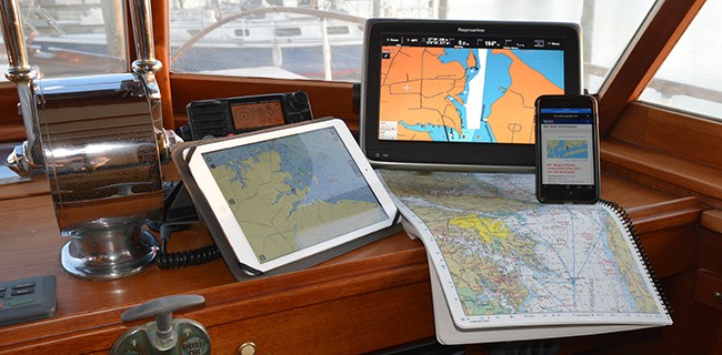
The evolution of digital navigation resources and printed charts is a hot topic among boaters who use electronic navigational charts (ENC), mobile apps and vector-based data. There are advances and updates in technology almost daily, and NOAA is leading the charge.
The Seven Seas Cruising Association (SSCA), Waterway Guide and Aqua Map have developed a not-to-be-missed webinar focusing on NOAA’s ongoing work and the state of navigation resources. Scheduled for December 10, 2020, 6:00 p.m. Eastern Time. The webinar will be delivered via Zoom and a $5.00 fee is required for all non-SSCA members. The fee covers registration and data storage for the content and delivery via Zoom. The webinar will be available for viewing several weeks beyond December 10 for registrants. Register here.
The National Oceanic and Atmospheric Administration (NOAA) creates and maintains the nation’s nautical charts and publications for U.S. coasts and the Great Lakes, including over a thousand charts covering 95,000 miles of shoreline and 3.4 million square nautical miles of water.
NOAA personnel will attend this interactive webinar to discuss current and future marine charting, answer questions about the magenta line, ENC data, chart management and accuracy. If you use paper, raster or electronic charts, a chart plotter or mobile apps, this webinar is for you. Learn about chart updating, sunsetting of paper and raster products and the future of NOAA charts that we all use.
Webinar Presenters:
Colleen Roche - North East Navigation Manager in the National Oceanic and Atmospheric Administration's Navigation Services Division.
Colby Harmon - Staff cartographer and project manager in the National Oceanic and Atmospheric Administration's Marine Chart Division.
Steve Soherr - Customer specialist within the NOAA Office of Coast Survey Navigation Services Division.
Bob Sherer - Contributing editor to Waterway Guide Media, author and coastal navigation expert.
Giorgio Ghiggini - Principle of GeoData Engineering, Viareggio, Italy, designer of the Aqua Map mobile navigation application.


- 4,000 Marinas
- Thousands of anchorages
- Updated Charts
- Mile-by-Mile Navigation
- Highlighted Alerts & Cautions
- Full-Color Aerial Photographs

The Waterway Guide App Makes it easy to leave reviews, use our explorer, and view waterway guide materials all on the go!


