Under, over, around or through? For 70 years Waterway Guide has helped boaters navigate bridges and locks from the Great Lakes, the Gulf Coast, all along the Eastern Seaboard and throughout Southern climes. This week we're taking a deeper dive into the Bridges and Locks listings that Explorer offers.
Timing is everything. We display Bridges and Locks in Explorer as overlays on our mapping architecture. These details are important in order to time your arrival to bridge openings and meet the schedules at locks.
All the bridges and locks shown in the Explorer have been visited by on-the-water cruising editors, staff and selected contributors. To reduce clutter and confusion, we provide a single symbol to represent each location.
Bridges and Locks and their conditions are posted across all the regions that we cover in Explorer, as well as any alerts pertaining to them. Details are regularly updated through our vast network of on-the-water editors, writers, and contributors.
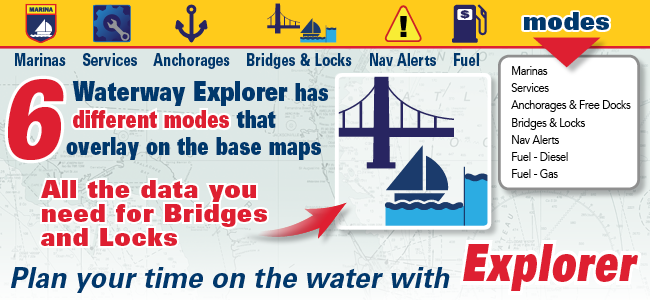
Other functions in Explorer list current information on Services, Marinas, Navigation Alerts, Fuel Prices, Anchorage & Free Docks and more. Explorer does not require you to sign in or purchase a subscription.
Once in Explorer, simply select an icon for a pop-up box that displays important & concise information. Then select the Bridges and Locks listing for more detailed information.
Users are also invited to add their own reviews and information on the locations they select.
The Explorer provides boaters with a simplified environment for planning trips by providing content that is relevant and verified.
Because our content is validated and posted by editors and staff, noise and guess-work associated with irrelevant and inaccurate content are alleviated. News, reviews and other features in the Explorer help provide a comprehensive source of information for captains and skippers.
New Waterway Guide Integration into Popular Navigation Apps
Waterway Guide continues to open its database of marine-related information to users of popular navigation apps that now include Aqua Map, SEAiq and iNavX, with more pending. The information is shown as overlays on the charts as one of six symbols that include an alert for hazardous conditions, marinas, anchorages, free docks, bridge data, and lock information. Tapping a symbol results in a popup containing detailed information on the item of interest. Best of all, the data is stored in the app and no internet connection is needed except for periodic downloads.
The staff at Waterway Guide participates in this ensemble effort every day to gather and disseminate up-to-the-minute navigation alerts and information to help keep boaters informed and safe. We’ve been doing this for over 70 years. The only thing that has changed is technology.


- 4,000 Marinas
- Thousands of anchorages
- Updated Charts
- Mile-by-Mile Navigation
- Highlighted Alerts & Cautions
- Full-Color Aerial Photographs

The Waterway Guide App Makes it easy to leave reviews, use our explorer, and view waterway guide materials all on the go!


