The cold waters north and east of Cape Cod are the birthplace of much of America's maritime heritage. Every harbor and almost every ledge carries a piece of American history or a legend of the sea. Cruising these waters gives the modern-day sailor a strong feeling of sea tradition.
The fastest traditional sailing ships the world has ever known sailed out of these ports including the great clipper ships Flying Cloud, Sovereign of the Seas and Lightning, among others. Often considered the most seaworthy and able sailing vessels ever built, the huge Gloucester fishing schooners made their fame and fortune fishing the Grand Banks in the dead of winter. They were designed and built along the river banks near Cape Ann.
Cruising Conditions
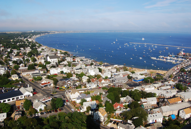
Navigating Cape Cod's waters, shaped like a sandy arm extending into the Atlantic, offers a path through history from Plymouth to the Down East coast. While some opt for coastal exploration, others venture from Cape Cod Canal's eastern end for offshore adventures to places like Gloucester, Portland Harbor, or directly to Acadia National Park through whale-rich Stellwagen Bank. Preparation and adaptability are key due to the area's open water passages, colder water temperatures, and the potential for sudden fog and weather changes. The region demands respect for its colder waters, frequent fog, and significant tidal ranges, which can impact cruising plans.
The passage through or around the crooked elbow of Cape Cod may not win you an earring like crossing the equator, but it marks a major step for most coastal cruising plans and the entrance into an endless mariner's paradise. To cruise "above the Cape" is to venture farther away from civilization and the recreational boating crowds. Self-sufficiency and competent seamanship become more important. The water is colder, weather changes quickly, the fog is thicker and the ledges are crueler in the swells of the open ocean. The sea here can be less forgiving to carelessness and inexperience than any other waters we cover. There are no barrier islands offering an "inside passage" and protection from the sweep of the sea, except in small cross-cuts between rivers and deep in the bigger bays.
Anchoring & Mooring
Designated Special Anchorage Areas are available in which vessels of less than 20 meters in length are not required to show anchor lights, day shapes or sound signals. Anchoring within a Special Anchorage Area does not require permission but permission for the use of mooring balls, within or outside of a Special Anchorage Area is required. In spite of the proliferation of mooring balls, it is often possible to still find places to anchor, both within and outside of the Special Anchorage Areas, keeping an appropriate distance from mooring balls, channels, docks, boatyards and marinas (not to mention other boats).
Note: In this area, the term "yacht club" doesn't necessarily mean private, as it does farther south. Many private clubs welcome transients and not necessarily from reciprocal yacht clubs.
For more details on cruising the Cape Cod area, including:
See Chapter 14 of the Waterway Guide Northern Edition.
Already a Waterway Guide Northern subscriber? Click here to read the chapter.


- 4,000 Marinas
- Thousands of anchorages
- Updated Charts
- Mile-by-Mile Navigation
- Highlighted Alerts & Cautions
- Full-Color Aerial Photographs

The Waterway Guide App Makes it easy to leave reviews, use our explorer, and view waterway guide materials all on the go!


